Jasper National Park’s Tonquin Valley is known to be one of the most scenic and popular backcountry spots in all of the Canadian Rockies. Find out why this trail is so popular, what you need to know before heading in, and why the Tonquin might be a bit over-rated, maybe.
(This post contains affiliate links for your convenience. As an Amazon Associate I earn from qualifying purchases. If you make a purchase through my link I receive a small commission at no added cost to you. See my policy page for more information)
About the Tonquin Valley
The Tonquin Valley lies hidden in Jasper National Park’s backcountry, south-west of Jasper townsite. It can be accessed via two separate routes, both climbing up into the lush alpine valley. To the west of Amethyst Lake sits the Ramparts, a giant wall of rock and glacier, keeping sentry over the valley below.
Elevation and distances:
| Location | Elevation | Distance |
| Astoria Trail head | 1737 m / 5700 ft | 0 |
| Astoria Campground | 1690 m / 5545 ft | 7.1 km |
| Switchback Campground | 2067 m / 6781 ft | 13.8 km |
| Clitheroe Campground | 2080 m /6824 ft | 17.2 km |
| Surprise Point Campground | 1978 m / 6491 ft | 19.4 km |
| Amethyst Campground | 1985 m / 6512 ft | 20.4 km |
| Maccarib Campground | 2012 m / 6600 ft | 23.8 km |
| Maccarib Pass | 2206 m / 7239 ft | 31 km |
| Portal Campground | 1979 m / 6494 ft | 34.6 km |
| Portal Trail head | 1494 m / 4914 ft | 43.3 km |
Note: These numbers are not exact. It seems guide books, maps, and signs have a hard time agreeing on the specifics. Above are distances according to Parks Canada’s website. (See end of post for sources)
Hiking and Camping in the Tonquin Valley
Trail heads and location
You can access the Tonquin Valley via two routes. You can enter either at Portal Creek (close to Marmot Basin Ski Hill) or the Astoria River (close to Edith Cavell)
To get to the Portal Creek trail head:
Head south from the junction of Hwy 16 and 93. After about 7.5 km turn right onto 93A. Once on 93A, climb up a twisting road and take your first right onto Marmot Basin Ski Hill Road. Follow this about 6.5 km to the Portal Creek Parking lot.
To get to the Astoria (Cavell) Trailhead:
Head south from the Junction of Hwy 16 and 93. After about 7.5 km turn right onto 93A. Take your second right onto the Edith Cavell Road. You’ll follow this windy road almost to the end. Just past the Edith Cavell Hostel there will be a parking lot along the road on your right side. Watch for signs.
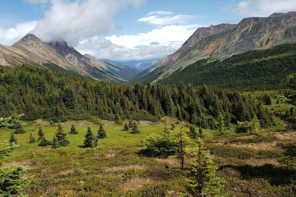
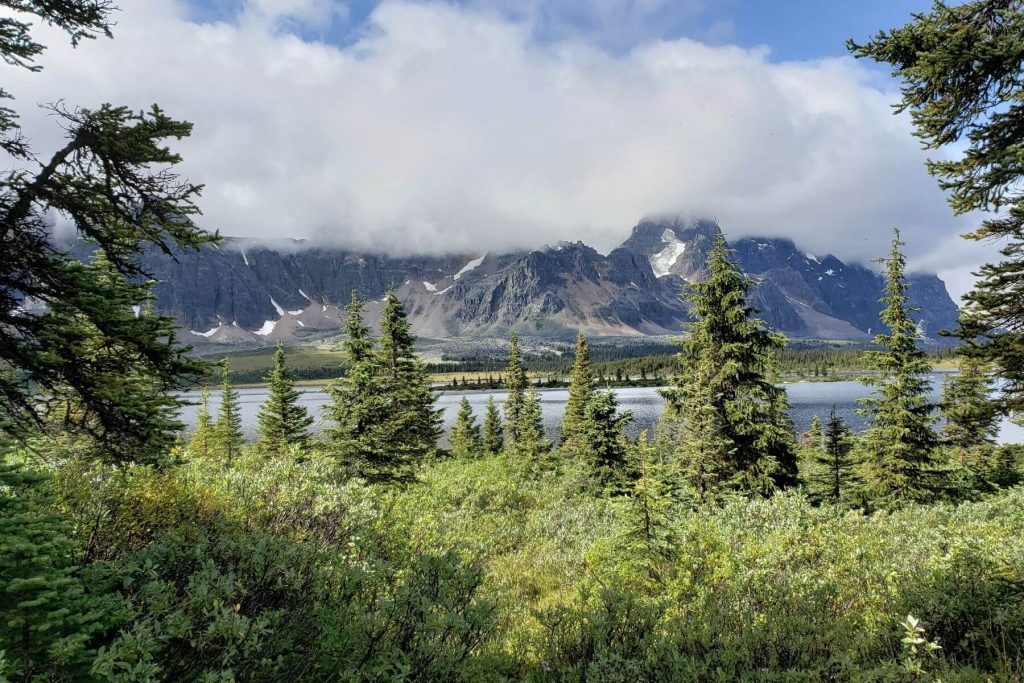
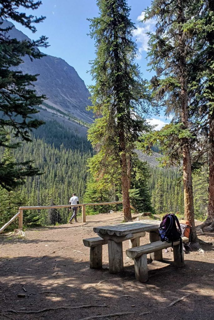
Pretty view point: A few hundred meters into the trail you will see this:
Which route will you do?
This is debatable and depends on your goals for the hike. You can go in and out the same trail or make a whole traverse. You’ll also want to consider your camping destinations and which route makes more sense distance wise.
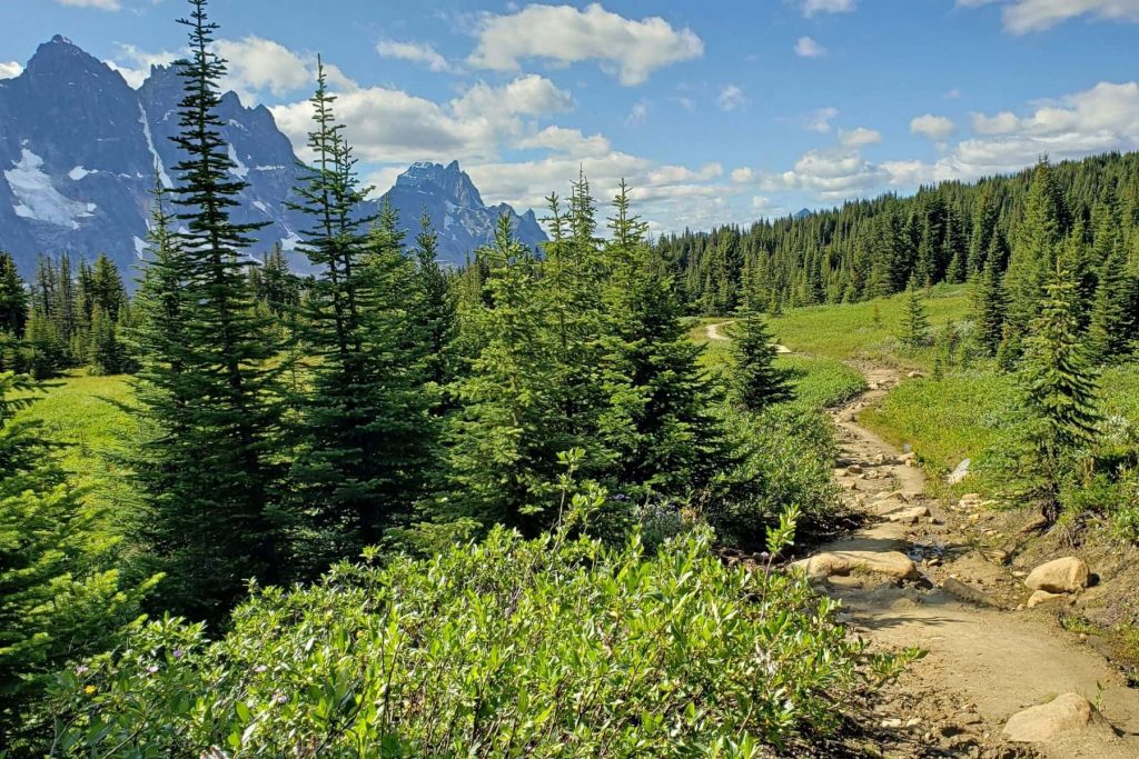
Many feel the Portal Creek route is more scenic as you’ll find yourself on the mountain side crossing old avalanche paths and looking down to the creek below. This route also includes Maccarib Pass, a wide high moutain pass offering wide mountain panoramas.
The Portal Creek trail head is lower in elevation than Astoria River (Cavell) trail head. This means you’ll have more elevation to climb taking the Portal route, but over the course of the entire hike and all the ups and downs a few hundred meters is relative, right? It has been said that the Portal route may be dryer. However, this was not the case on our trip.
The Astoria (Cavell) route gets you into the valley a bit quicker. This access crosses a recent rock slide with many warnings of unstable boulders and debris. Understandably, we crossed this quickly. Volunteers have been working hard at keeping this section of the trail safe and passable. As with any hike, you’ll want to confirm the current trail conditions before heading out.
Entering at Astoria is a better option if you are only wanting to explore Surprise Point, Chrome Lake, or the Eremite Valley.
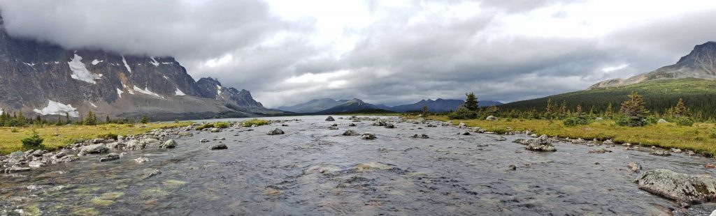
Most Scenic Spots in the Tonquin Valley
I’ll admit that it was cloudy and rainy when we visited the valley. I feel like I didn’t get to fully experience all the Tonquin had to show me.
However, even in those crappy conditions, the weather did break from time to time, and some of the scenic highlights for us were:
- The view from the wooden bridge close to Surprise Point campground at the southern tip of Amethyst Lake
- Looking out towards the ramparts from the area around Amethyst lake campground
- At an unnamed viewpoint at the top of the unnamed trail above Maccarib campground
- And, the alpine meadows of Maccarib Pass.
How many days does it take to hike the Tonquin Valley?
Again, this depends on your goals.
If you’re the type of person who doesn’t mind a 40 km day hike you could make it to Amethyst lake and back before the sun sets.
I am not that person.
Many hikers will head straight to Surprise Point or Amethyst Campground in one day, spend a night or two then head out again. Some will spend a few days at Clitheroe and take day trips to explore the rest of the valley.
Or, you might choose to do a traverse staying at different sites along the way, cutting your days into smaller distances.
We took 4 days to do the trail. 2 – 4 days is typical. We even met a dad and his 5 year old on the trail and they were taking 6 days stopping at almost every campsite along the way.
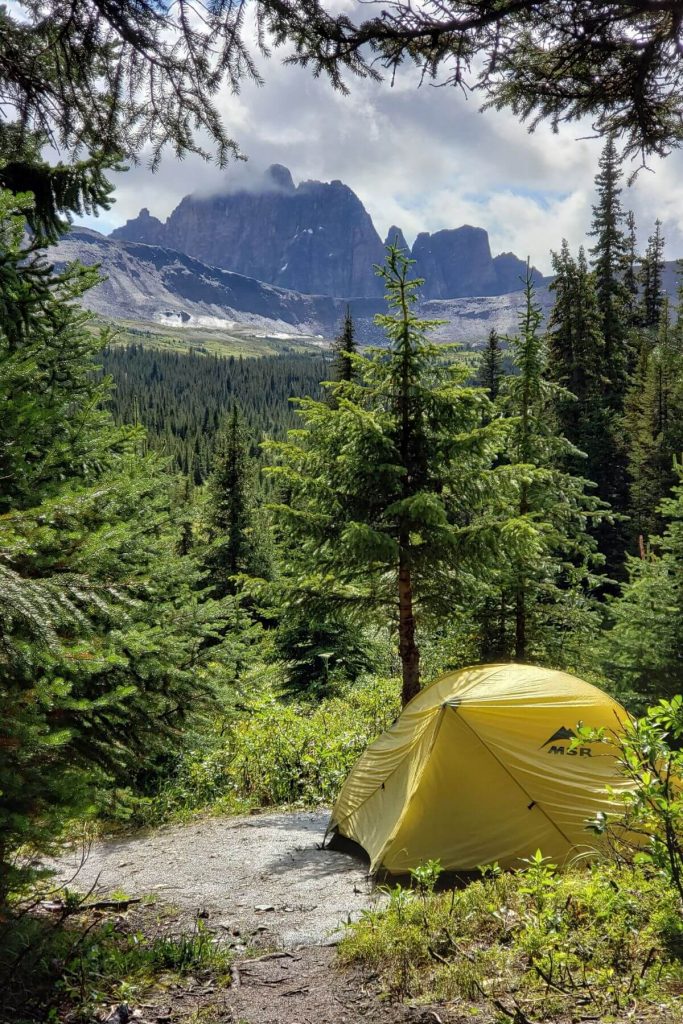
Camping in the Tonquin
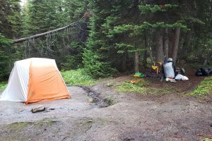
There are 7 wilderness campsites along the Tonquin Valley trail. Swithchback, Clitheroe, Surprise Point, and Amethyst are in the Valley, while Astoria and Portal are located on the trails heading in/out of the Valley.
Some sites are prettier and better positioned than others. But, all the campsites offer the same basic fare… moderately treed for shelter, a few picnic tables, a bear box (to safely store food and toiletries), toilets, and a fresh water source relatively close by. Campfires are not allowed in the Tonquin.
I would think Surprise Point and Amethyst have the biggest potential for the grandest views and also the worst bugs, being right down in the wetness, close to the lake.
At each campsite the tent pads are well-marked with a little numbered sign. In most locations the tent pads even have a nicely dug trench surrounding the spot to help water drain away. If you’re lucky, you might even find a spot with leaf shelter above the tent or a small treed shelter for your bag and gear to stay dry close by.
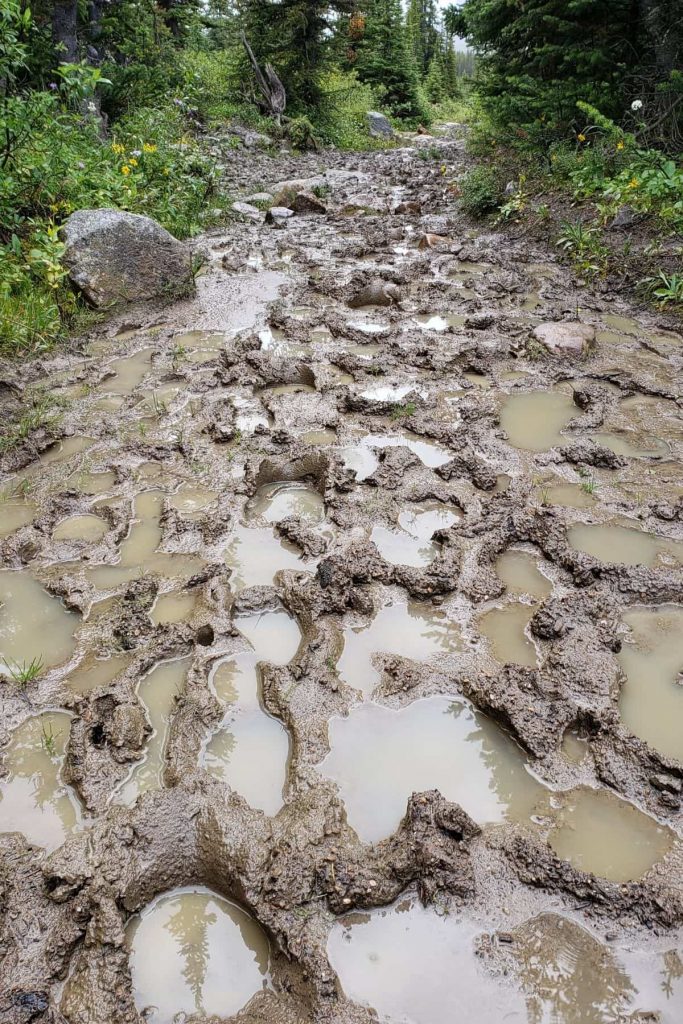
On our trip, the tent pad trenches were in rough shape since it had pretty much rained for 3 months straight. But, surprisingly, even though the trails were mudways through the forest, the tent pads were solid and in good shape.
That can’t be said for the rest of the campsite though. Often the paths around the sites and to and from the bathroom were very muddy and slick.
Campsites of the Tonquin
Astoria – densly treed sitting high above the Astoria river
Switchback – moderately treed with views of the surrounding mountains
Clitheroe – densly treed with some views of the Ramparts. A warden’s cabin is near by.
Surprise Point – an open and less sheltered campground close to the Ramparts and Amethyst Lake. Beautiful views.
Amethyst – exposed and minimally treed, located centrally in the valley and close to Amethyst Lake. Beautiful views.
Maccarib – sitting on a little hill above the river, this treed site is nicely treed with good views.
Portal – a hill-side campground with dense trees but open views to the mountains
Bathroom Breaks on the trail
I’m adding this in because I get asked a lot about outhouses. So, here’s the deal.
If you are hiking in the back country in Jasper National Park, there are no bathrooms along the trail. You will find outdoor pit toilets at all the Parks Canada campsites. Worst case scenario is a log across an open pit!
But, in the Tonquin, you’ll be treated to either green plastic toilet thrones or toilets built up over barrels, stadium style. Both options are open air… no walls, no roof, great views.
In between campsites go find yourself a private spot – please leave the trail to do this!
When’s the best time to visit the Tonquin
Well, if you ask any seasoned Jasper hiker, they’ll tell you late August or September. Why? Because of bugs and mud!
Apparently on a ‘normal’ year, the trail starts to dry out early August. And, bugs are typically really bad in there for July and possibly tolerable for August. Come September, the bugs are usually gone.
What about June? The trail might not even be passable until late June or early July. So, June’s not really a good time.
Logistics, permits, and planning
In order to camp anywhere in Jasper National Park, you’ll need camping permits for every site you plan to stay at.
Backcountry reservations can be made via the Parks Canada online reservation system beginning in January of each year. Yes, it is super challenging to guess the upcoming summer conditions, but just spin the bottle and pick a date.
The reservation system will prompt you to choose a trail head location and choose a campsite location for each night of your trip.
You can also make these reservations by telephone or at the Park’s Information Center in the town of Jasper.
Years ago, when we were young and reckless, we’d just drive to Jasper, stop at the Info Center, book our back country spots that night and start hiking the next day. If you plan to hike the Tonquin, you won’t have success getting spots that way any longer.
In fact, when I booked reservations for our Tonquin trip of 2019 I was on the reservation system 20 minutes after it opened up and already campsites were full and reserved and we had to amend our preferred hiking route.
transportation: If you are planning to hike in and out at different locations you’ll want to make sure you’ve arranged for a drop-off or have vehicles waiting. There is no cell reception at either of these parking lots so you can not call for a ride when you arrive.
Kids in the Tonquin?
Sure!
I’ll admit, Tonquin Valley isn’t the first thing I think when someone asks for kid-friendly hike suggestions in Jasper. But after meeting a little adventurous 5 year old last year, I think this trail is totally doable for kids….
As long as your kids are open-minded, tough, and positive! (And, that describes you too!)
This trail is long and it does have challenging climbs. There was a lot of mud… like miles of mud. And rocks and bugs and unpredictable weather.
But, this particular dad/son duo had it down! Dad carried all their gear and the little guy was bundled up well and appropriately dressed with water-proof hiking boots and full-body rain gear. They’d start their day with oatmeal (and chocolate chips) and take it at the little guy’s pace… lots of breaks and time to explore.
By breaking the hike up into 6 or 7 days and staying at each or almost every site, the longest distance between sites would be just over 10 km. But, at such a long trip you’ll have much more food to carry.
This is not the hike to try first – either for you or your kids.
Another option for families could be using the outfitters to carry people and or gear. More on that below.
Check out this post for more information on getting your kids ready for back country hiking and camping.
Other Stuff
Fishing
I’ll be honest. I don’t fish. But, lots of people apparently enjoy fishing. And, apparently, the Tonquin Valley is a great spot to do this.
Many groups of hikers we met on the trail were carrying a fishing rod strapped to their packs. It may be possible to rent boats from the outfitters to get out onto Amethyst lake for some very quiet and scenic fishing.
Do you need a license to fish in Jasper National Park? Yes. You do. Find out more about fishing in the park here.
Lodges
If sleeping in a dry warm cabin and eating super yummy food that you didn’t haul in on your back is more your style, then you’ll want to check out these options.
It’s a long day to hike into the lodge, but without a heavy pack it is manageable for regular hikers. You can also arrange to get in by horseback through the outfitters below.
During ski season these lodges are a very popular destination for back country skiers.
Currently (as of January 2020) there are 2 outfitters licensed to maintain lodges in the Tonquin Valley:
Tonquin Valley Backcountry Lodge
You can stay here during hiking and ski season. You can get lodging, meals, or both. They have horses and offer guided horse back trips.
Tonquin Valley Adventures
Offering cabins and rooms in a lodge, these outfitters also offer lodging, meals, or both for the ski and hike season.
Bugs
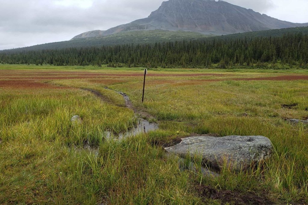
The Tonquin Valley has one big lake fed by snow and glacier melt waters. The area is marshy, and wet. So, yes, there are a lot of bugs. Mosquitoes and flies are most bothersome mid July to mid August but will ultimately depend on that season’s conditions. Make sure to bring ample bug repellent and even a bug mesh hat if that’s your thing.
Choosing campsites that are further away from the lake might help. However, I’ve been told that when the bugs are bad in the Tonquin there’s no escaping them, anywhere!
Horses
Another thing you can’t escape in the Tonquin… horse poop!
The backcountry lodges offer horseback riding into the Valley. And, unfortunately they largely use the same trail as the hikers. Not only do horses leave presents all over the trail, they also create an obstacle course of turned rocks, pits, muck, and exposed roots. Walking on a churned up muddy horse trail is not fun.
You’ll also want to be cautious when passing (or being passed by) horse groups. Move off the trail if you can and talk normally as the horses pass so they are aware of your presence and you don’t startle them.
Weather
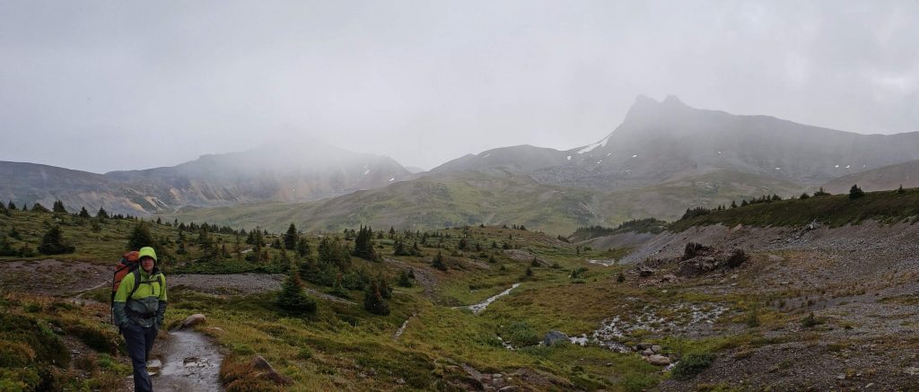
Just like anywhere in the mountains, the weather can change quick. Surprisingly quick.
At one point in our hike I was over-heating so stopped to take off my long-johns (that’s Canadian for your warm base layer). 15 minutes later we found ourselves hiking through a hail storm! And, since it was so cold and we were so exposed I didn’t dare stop to take my pants off and put my long johns back on!
Jasper mountain nights are cool. It is possible for night time temperatures to hit freezing at any time in the summer. Sure, if the day temperatures are in the high twenties that likely won’t happen. But, if the day time temperatures are in the low teens, with cloudless skies, expect the temperature to drop to 4 or 5 degrees Celsius overnight.
Animals
Caribou! The Tonquin Valley is home to one of Jasper National Park’s last surviving herd of Caribou. While 50 years ago people talk of seeing herds counting upwards of 100 caribou running through the meadows, now, sadly, those numbers are in the single digits.
FYI, dogs are not allowed into the Tonquin Valley.
Other animals of the Tonquin are the typical Jasper mountain creatures; such as, Grizzly and black bears, cougars, marmots, pika, eagles, moose, deer, and squirrels… and grouse.
Tales from the trail – notes from our last trip
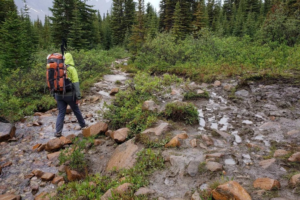
As I mentioned above, our trip into the Tonquin happened during a summer of constant rain. So, even though we booked our trip for late August, we arrived to find the trails were horribly muddy and in very poor condition.
My hubby tells me I’m exaggerating when I say that at least 80% of the entire route was a muddy mess. Either way, 80%, 60%… still amounts to hours of watching your feet, dodging, hopping, and not enjoying the scenery.
Many people we met complained of their feet hurting from endless rock hopping. And, even if you weren’t trying to go from rock to rock you still had to watch the trail closely as to not be tripped my upturned rocks, step in fresh horse poop, or slip on slick clay. I’d say hiking poles, gaiters, and good footwear are a must for this trail.
And, the scenery? … it wasn’t until our last day, on the hike out, that the clouds finally gave way and let us see the Ramparts in their entirety. And, yes, they were worth all the mud.
Our hiking trip into the Tonquin:
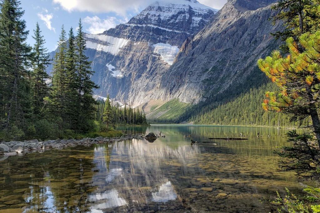
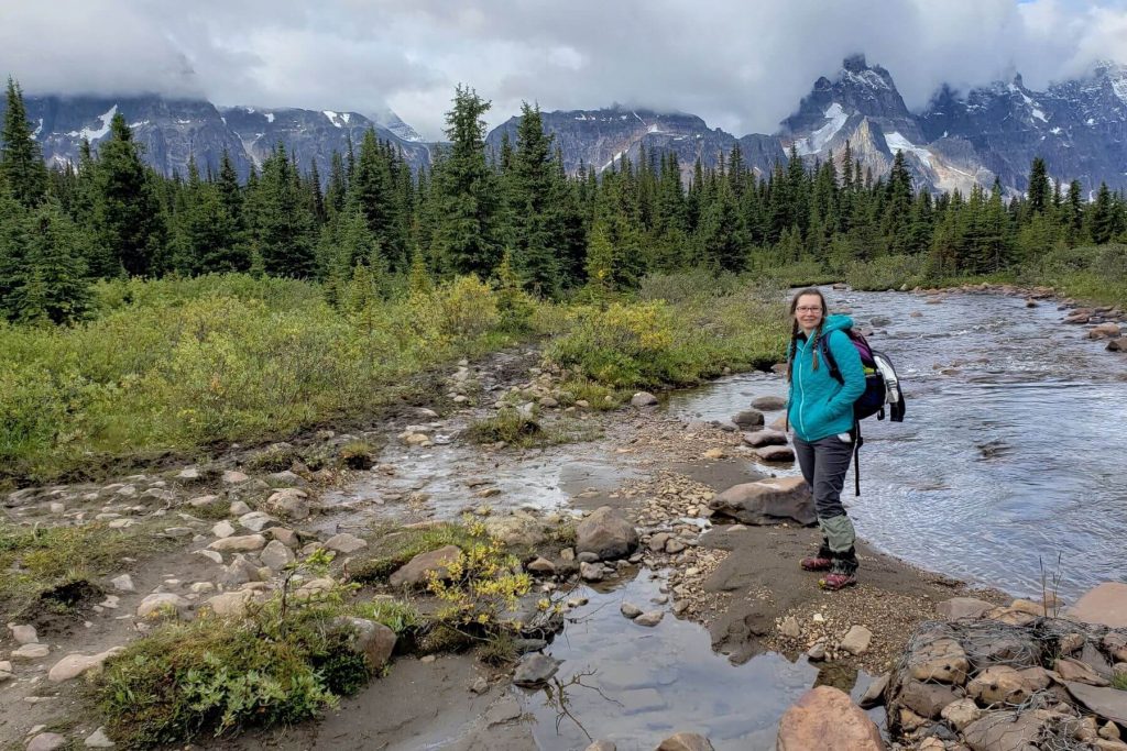
We choose to head in via the Astoria River (Cavell) route. This path begins with an open lake view straight to Edith Cavell, a very special way to begin the trip.
For the first 6 km, the trail winds down through the trees down towards the Astoria River Campground. The Campground is perched above the river and is a pleasant spot along the valley for camping or a picnic.
A bit past the campground is the junction into the Eremite Valley: Chrome Lake, and the Alpine Hut at Outpost Lake. Our route stayed on the trail curving around Oldhorn Mountain and leading towards the switchbacks.
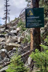
But, before climbing the switchbacks we first had to cross a recent rock slide. There were numerous signs warning us of the danger. These boulders were huge and the image of being flattened by one kept us moving quickly.
As a note here, thank you to the volunteers and staff of the Tonquin backcountry lodges who have been working hard to clear this portion of the path and make it safe for us all!
Somewhere around here (either before the boulder field or right after) is the last access to fresh water until you get to the top of the switchbacks.
The switchbacks: They weren’t actually as bad as I had imagined. The guide book says you’ll climb about 350 meters here over about 3 km. All I know is that it seemed to go on and on and on.
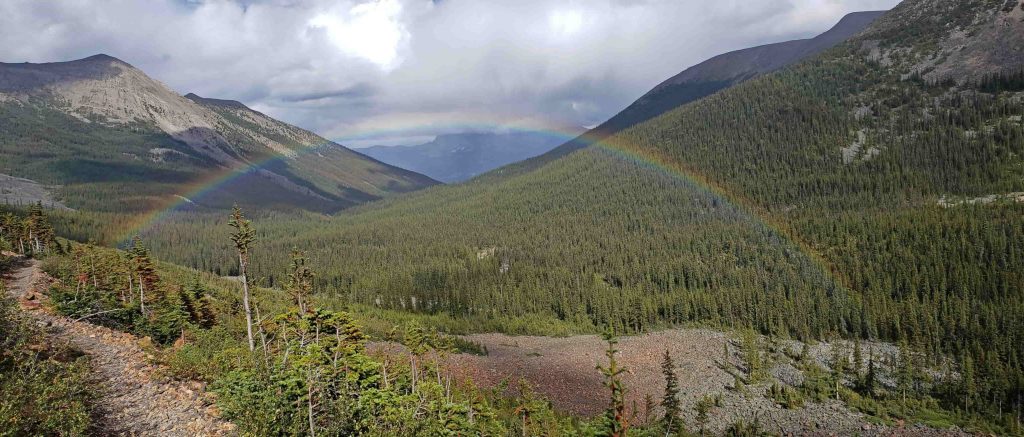
But, eventually, you get to the top and there’s that wonderful excitement as the world opens up and the Ramparts are there to greet you. Well, maybe, if the weather is cooperating.
We spent our first 2 nights at Clitheroe campground with intentions to spend our second day exploring Surprise Point and Chrome Lake.
Before this hike I treated myself to a new pair of trail shoes. (These are the exact shoes I bought and they’re great!) They were advertised as being waterproof, light, and comfortable (thanks Victor at Totem!). We knew we had the potential to encounter rain and mud.
What we didn’t know was how much rain and mud!
To get to Surprise Point we basically had to walk straight through watery bogs…. we’re talking Tolkien Dead Marsh – type bogs here, minus the bodies! The trail was marked by small green signs and you had to weave your way through mud, willows, grasses, and water while both trying to stay to the trail (if you could find it) as much as possible while also trying to keep yourself as dry as possible (which wasn’t actually possible)…. plus it was raining!
We also ventured out to see Chrome Lake and took refuge from the rain by eating our dinner on the porch of the retired warden’s cabin just downhill from Clitheroe campground. This was a good opportunity for my hubby to dry out his feet, socks, and shoes (since he did not treat himself to a new pair of waterproof shoes before the trip!).
Day 3 was our short, easy, and muddy walk from Clitheroe to Maccarib Campground. At times we were rewarded with glimpses of horses grazing in the distance. There even was an elusive caribou in the area that we didn’t see but other hikers had.
Thankfully the sun came out long enough at Maccarib to coax us out from under the trees and encourage us to explore the area.
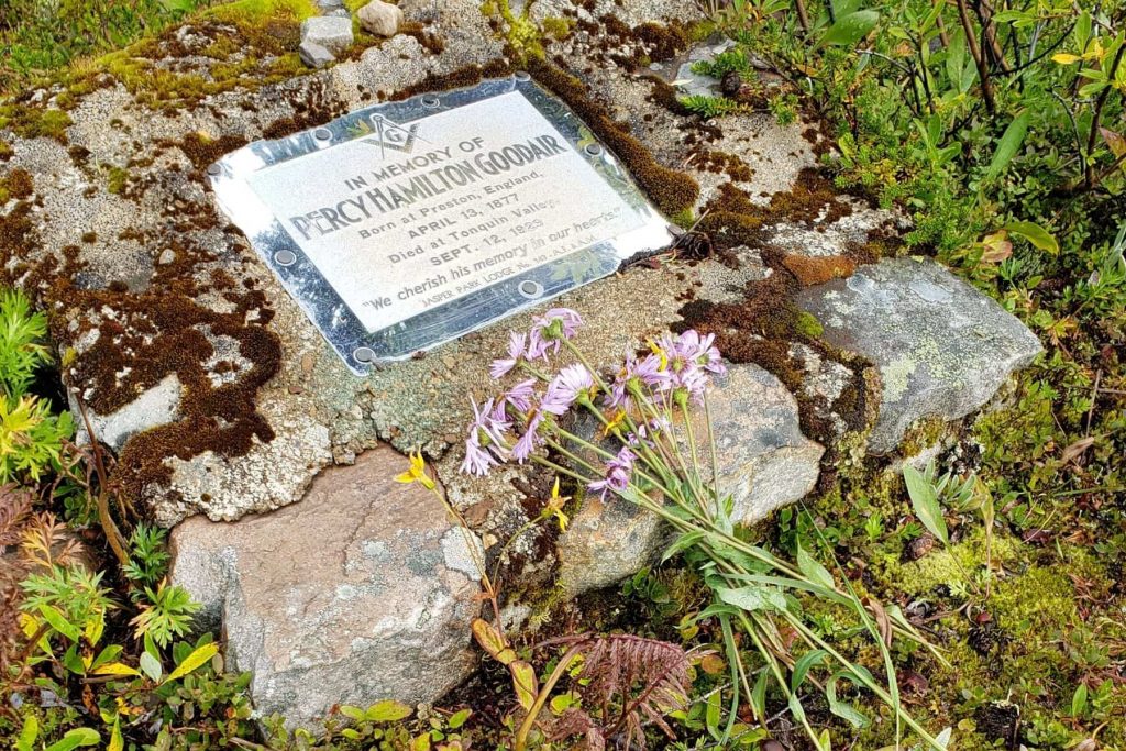
Just past the last tent pad at Maccarib is the grave of Warden Percy Goodair. I’ve tried to research the story, but have found different versions… what remains constant in the tales are two things: Goodair loved this valley, and men are no match for a grizzly bear.
The trail continues past that last tent pad and grave site. It’s a well maintained trail, but unmarked. Our curiosity piqued, we followed it.
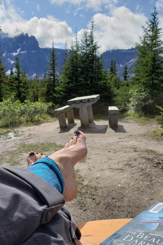
Aside from meeting a very excited and eager pair of spruce grouse (the two in the video above), we also found a lovely viewpoint perched up over the campsite, overlooking the valley. Had it not been wet and cold and had we brought along our food, this would have made a beautiful spot for dinner.
On our last day we left the Tonquin via Portal Creek. It was here that I stripped out of my long-johns only to find ourselves hiking through a winter squall at the Pass! My tush and face were frozen, but we continued through the pass with the wind at our backs and we managed. But oncoming hikers weren’t so lucky and tried to wait out the storm by comically hiding behind those tiny ancient trees found in the alpine!
But, true to Jasper weather, the storm quickly passed and the sun came back to warm us up and dry us out.
It’s almost 11km from Maccarib campground to Portal campground, then another almost 9 km to the parking lot. It was a long day out, but after Portal campground the trails were finally in decent shape and we could move faster.
A last note on the condition of the trails… although we hiked the Tonquin in a particularly wet year, I’ve been told that, even in dryer years, the trail, for the most part, is still beat up from the horses.
I think what frustrated me the most was that on sections that seemed virtually impassable and a small side trail had been made, there’d be horse tracks and holes and poop there too! Like even the horses didn’t even want to use their crappy trails! Ideally, I’d love to see two parallel trails – one for horses, one for hikers.
To Sum it up…
Regarding the Tonquin, “embrace the suck” is what I’ve heard one Jasperite say. And, it’s true, if you can’t handle the mud and everything else that might be sucky about the Tonquin Valley, then maybe this hike is not for you. But, if you don’t mind hiking in poop and mud while swatting at flies, then yes, add this one to your list for sure!
Other Jasper Reads you’ll want to check out:
- 2 Day Family Itinerary for Jasper National Park
- Everything Camping in Jasper
- Hiking Sulphur Skyline and Visiting the Miette Hotsprings Area
And make sure to sign up for monthly Jasper updates delivered right to inbox!
Sources:
- Jasper-Robson: A taste of heaven by Don Beers
- Jasper National Park Website by Parks Canada
- Hiking Jasper and Mount Robson by Rob Bryce
- Jasper South Topographical Map by National Geographic

Thank you for this article. I hiked Tonquin Sept 6-10 2022 and I am in love with it. We saw the gravesite, but didn’t take a photo and I was intensely curious about it. I found this article: https://www.fitzhugh.ca/battle-with-a-grizzly-ends-in-wardens-death-2/ that has some info.
Thank you for the blog of your trip. Can you please advise of the water / river source for filtering drinking water at the Clitheroe camp. Is it close to camp? Thank you in advance for your reply and assistance.
Hi Roger, thanks for your question. If I remember correctly, when we were there a few years ago, there was a stream right through the campsite. All the best, and checking the Parks Canada Trail report before heading out is always a great idea:) Happy hiking!
So. Much. Poop! Otherwise, it looks like a beautiful part of Canada. 🙂
Yes, the Tonquin Valley really is a lovely spot… just the mud and poop;)